Brookhaven Road Weather Sensor (RWIS)
 In a unique municipal partnership with GDOT, the City of Brookhaven has installed a Road Weather Information System (RWIS) at North Druid Hills and Buford Highway, one of the busiest intersections in Brookhaven. These systems are usually located along local state highways, and for Brookhaven, the closest sensors were several miles away. Now Brookhaven has real-time data much closer to home.
A RWIS provides valuable real-time data on weather factors including pavement conditions, precipitation amounts and visibility. It can determine if it is raining, snowing or sleeting, which can create hazards for drivers. Additional information available from the sensor station includes wind speed and direction, air temperature, humidity levels, and visibility.
In the past, Brookhaven depended solely upon the Georgia Department of Transportation (GDOT) and National Weather Service for the latest forecasts, but now that timely information will also be available closer to home. Knowing exactly what is going on with the roadway in terms of weather conditions and road temperatures is the key to successful decision making.”
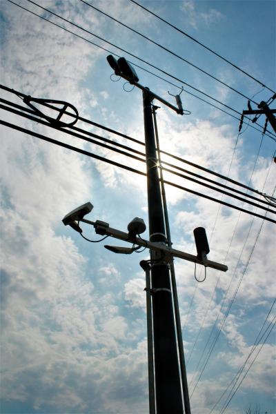
Components of the system, include a communication system enclosed in a weather-proof metal box; thermometers (for measuring air, surface and subsurface temperatures); a heated ultrasonic wind sensor (for measuring wind speed and direction); a heated visibility sensor (for detecting fog and smoke); and a barometric pressure sensor.
Anyone can access this data. Simply go to https://www.weather.gov/ffc/gdot_rwis to find a map of all area road sensors. Zoom in to Brookhaven, and click the green dot near North Druid Hills Road and I-85. All of the charts and tables will then show data for Brookhaven’s road surface and subsurface conditions in 10-minute increments.