Crime Stats & Mapper
The Brookhaven Police Department produces a yearly annual report summarizing city crime statistics, calls for service, officer activity, criminal investigations, arrest and citation data, and notable incidents from the year. Citizens can also use an online crime mapper portal to search for public safety incidents and arrests, and access other useful information. Click buttons below for links to the annual reports and crime mapper.
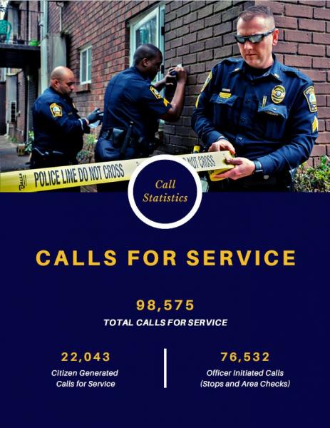
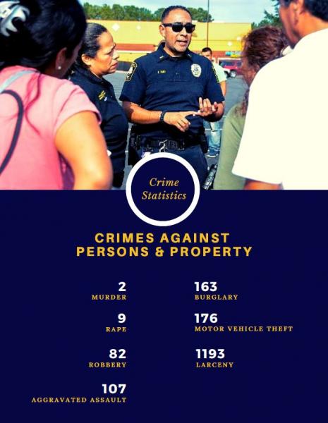
In 2020, the Brookhaven Department received 98,575 calls for service. 22,043 of those were citizen-generated calls for service, while 76,532 were officer-initiated calls, including traffic stops, business and residential security checks, and area patrols. Serious crimes against person data for 2020 included 2 murders, 9 rapes, 82 robberies, 107 aggravated assaults. Serious crimes against property data included 163 burglaries, 176 motor vehicle thefts, and 1,193 larcenies.
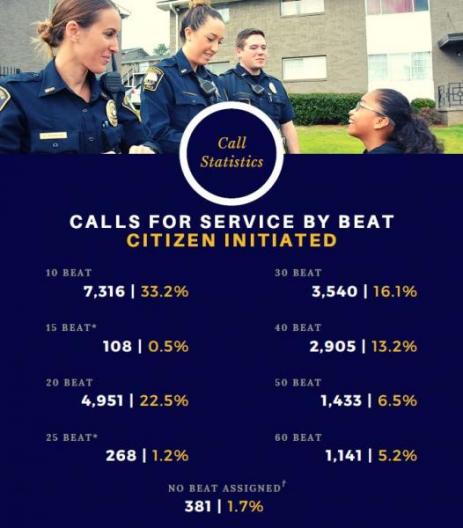
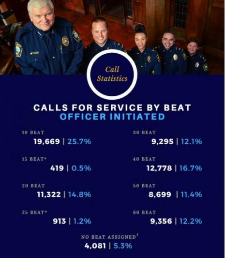
Brookhaven Police in 2020 compared calls for service against officer initiated activity, separated by police beat (district). The purpose of this assessment was to determine whether officers' self-initiated activity was proportionate to crime levels in specific areas, to prevent bias-based or "over-policing," and to assess resource deployment. The graphs below show comparisons between citizen- and officer-initiated calls, with citizen calls shown in gold and officer's initiated activity in blue.
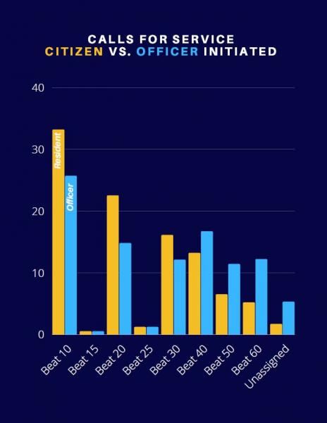
*Beats 15 and 25 were made active in Computer Aided Dispatch (CAD) and the Records Management System (RMS) in November-December 2020, and these data represent only those two months (in some cases, less). Beats may not be assigned to calls for service for which Officers are summoned outside the City limits to make reports of incidents that occurred here; incidents that begin or conclude outside the city limits; and/or as the result of CAD entry errors by 911 dispatchers.
The additional police activity in Beat 40, consisting primarily of the Peachtree-Road Corridor, is attributed to traffic enforcement and pedestrian safety activities and to business patrols in the primarily commercial district. Additional police activities in beats 50 and 60 are primarily attributed to additional residential security checks as both beats are primarily residential areas.
The tables below illustrate the raw data and percentage points from which the graph above was created.